


Writtten By: Nicole Starosielski
In the short story “White Noise” a pair of telecommunications engineers travel to an undersea cable landing station on the Red Sea on a routine maintenance trip. Upon their arrival, they see a speaker mysteriously hooked up to the submarine circuits. A live feed is being broadcast from the bottom of the ocean. Animals are silently gathered around, tuned into the subaquatic transmissions—a set of historical vibrations trapped in the ocean’s endlessly circulating cold currents. As the engineers detect human voices through the clash of metal, and rumbling wheels, they realize that they are hearing Moses cross the Red Sea. The undersea cable is not simply a conduit between continents, but a circuit between past and present. In “White Noise,” the undersea cable station is the location of this exchange, a place haunted by its past and a site where connections between technical networks and historical circulations are aurally manifested.
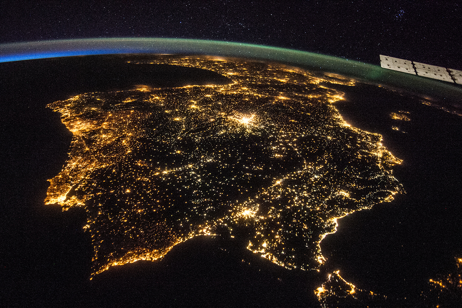
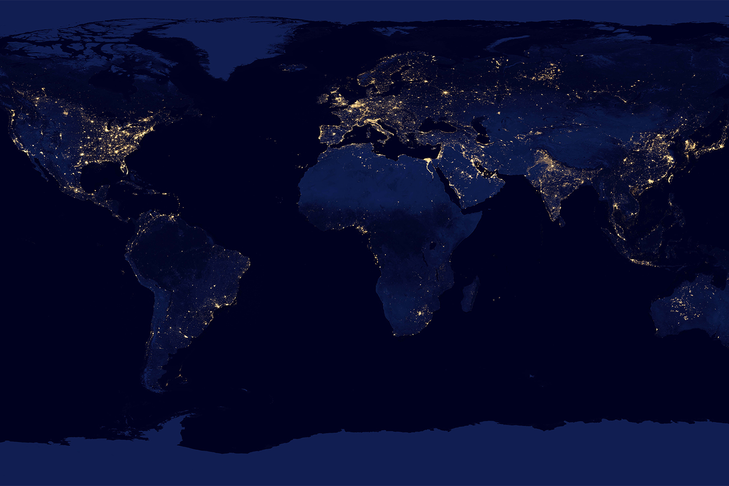
This photo essay charts the remnants of undersea telegraph stations in the Pacific with the aim of opening a similar conduit between networks past and present. Though we often imagine contemporary media and communication as moving us beyond territorial limits, almost all transoceanic internet traffic currently runs along more than half a million miles of undersea fiber-optic cable. These cables have rarely developed in isolation and are often grounded in existing transportation and resource systems. Internet cables tend to follow the paths of analogue telephone cables from the 1950s, which were in turn layered over telegraph systems from the previous century. Telegraph lines trace the vectors of other historical movements, including mobilizations of bodies, goods, and ships via colonial networks. Between layers of infrastructure development, the cable station has often served as an invisible gateway for exchange, a place where the spatiality of one kind of network is tied into another.
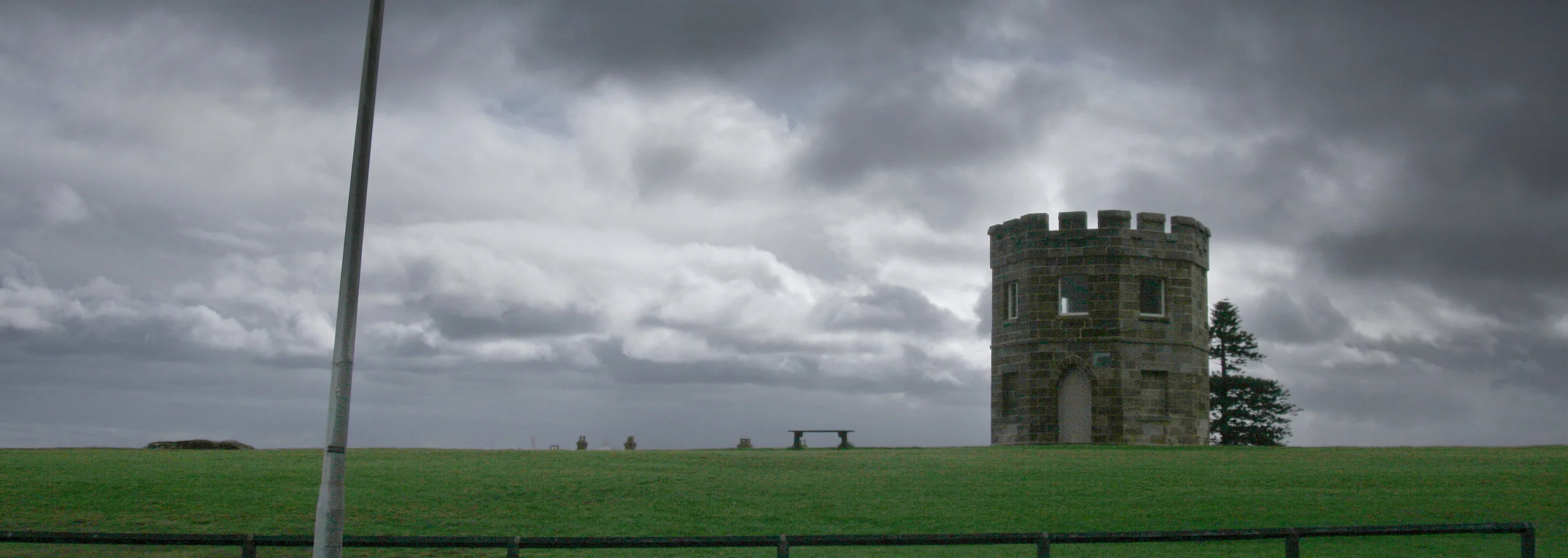
Figure 1. A watchtower looks over Botany Bay at the site of the La Perouse cable station, a point of Australia’s connection to New Zealand from 1876 to 1917.
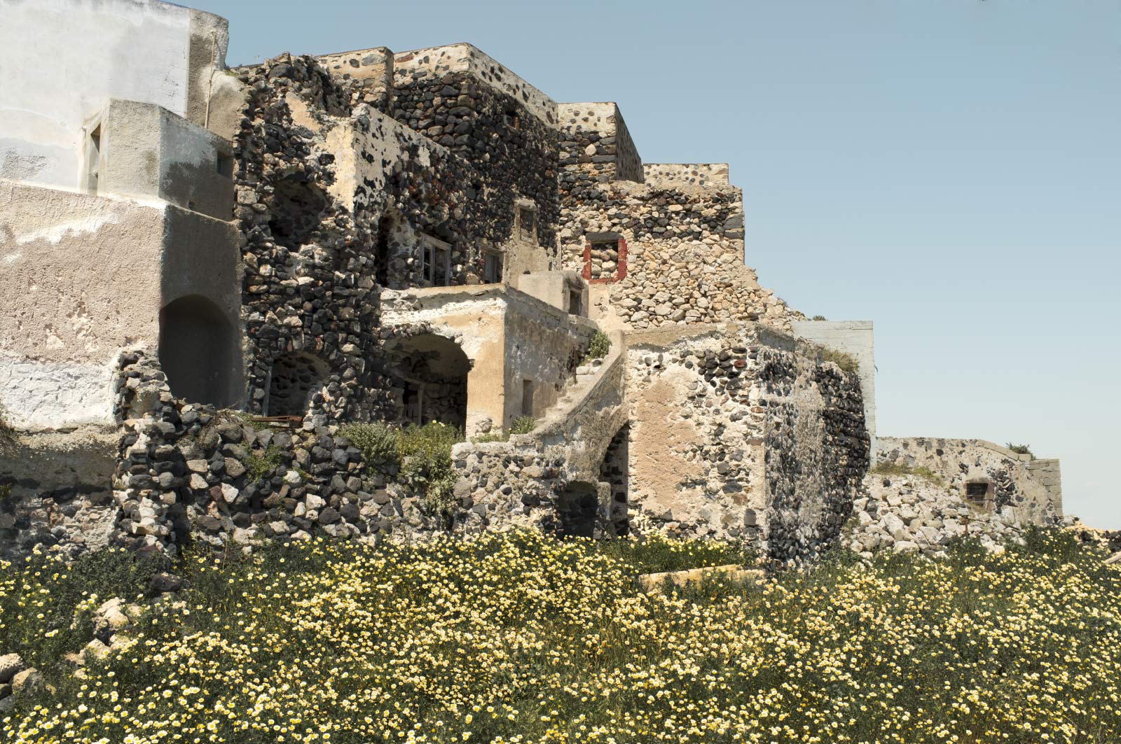
As a result, cable stations play a role in stabilizing networks over time. In Australia, cables were brought ashore at Botany Bay, the site where Captain Cook first staked the British Flag in 1770 and where French explorer La Perouse landed in 1788. Although it was ten kilometers south of Sydney, Botany Bay was selected as a site for a cable station in part due to this proximity to nautical traffic and ship landings, which in turn helped to attract military and defense installations. Even after the telegraph station closed for signal traffic, the building continued to serve surrounding publics – emergent circulations continued to leverage the resources of existing nodes. It was used briefly as quarters for Coast Hospital nurses and subsequently as a women’s refuge operated by the Salvation Army. Traffic was eventually redirected to central Sydney, landing at Bondi Beach, where internet signals continue to enter Australia today. The builders of at least one subsequent cable system, however, still toyed with the idea of returning to La Perouse. The old cable station building (now a museum housing the artifacts of transnational communication), a nearby watchtower originally meant to look out for smugglers, and a monument named for the early French explorer all serve as reminders of the location’s significance in drawing in heterogeneous historical currents.
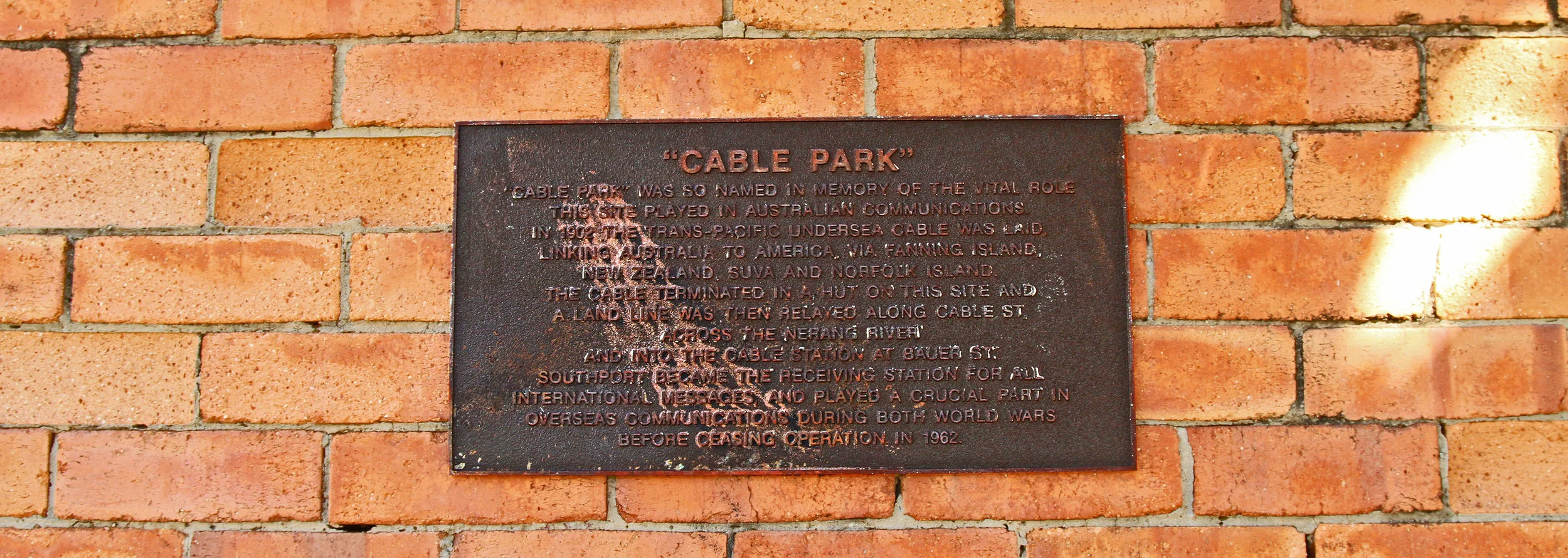
Figure 2. A plaque graces the side of the old cable hut at Southport, Australia, where the Pacific Cable Board’s systems operated between 1902 and 1964.
The cable station is a location where network history materializes and becomes visible, aural, and perceptible. It is the architecture in which history is celebrated and displayed, where generations of communications workers construct a sense of shared tradition, and where major network transitions are experienced. Our treatment of the early cable stations evidences, in part, a cultural relationship to communications past. In Southport, Australia, it is hard to miss where the cable landed, even though the station is no longer there, since a park, a street, and an apartment building have been named after it. The cable hut still stands, and is marked in the Queensland Heritage Register as an important site of cultural history. When the station’s owners sought to tear down the buildings to build a retirement home, residents spearheaded a campaign to transform them into the music complex of the local Southport School. In “Cable Park,” a monument commemorates the Pacific Cable Board telegraph system. A large map, engraved in metal, delineates its colonial routes, extending outward from Southport, connecting to Norfolk Island, branching off to New Zealand and to Fiji, from which it snakes northward to Fanning Island and eventually Bamfield, Canada. A quote from Shakespeare, “I’ll put a girdle round about the earth in forty minutes,” anchors the system in British history.
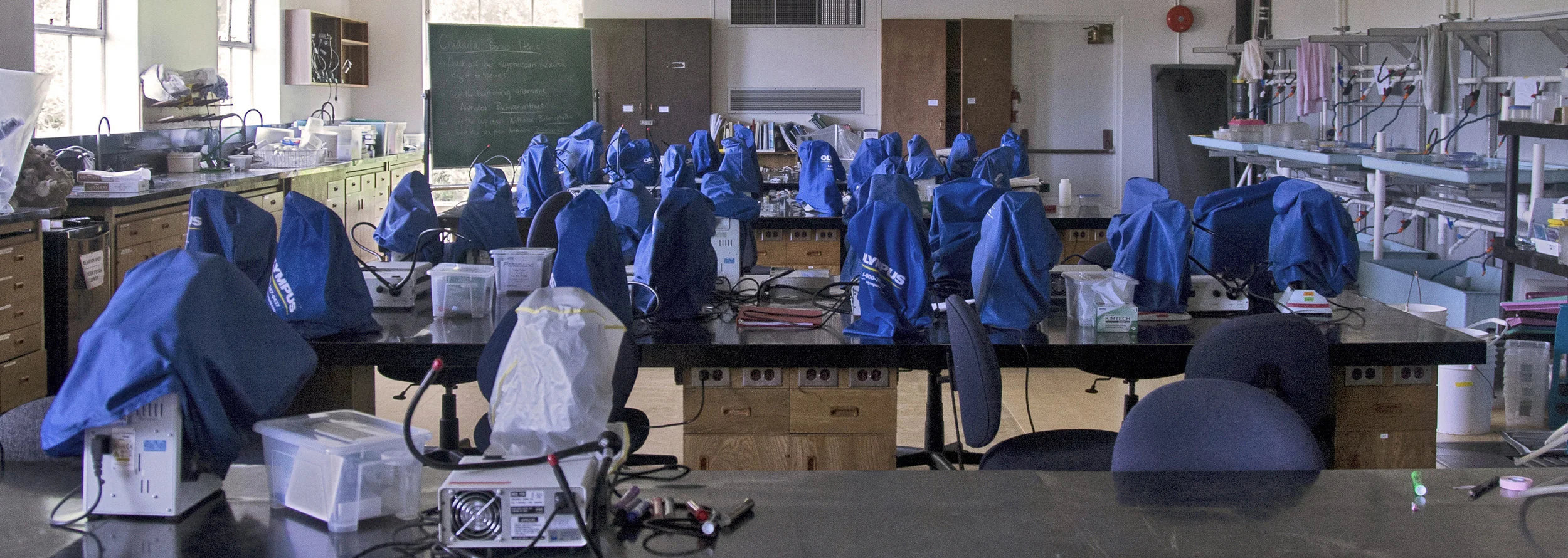
Figure 3. The telegraph rooms at the Bamfield cable station, which operated from 1902-1959, have since been turned into science labs
The first set of British and American colonial stations in the Pacific were typically located in remote environments. Cablemen were a critical part of the circuit and spent long days transmitting and re-transmitting signals. The large and often out-of-place complexes built to house them were later valued as support architectures for local and regional projects. As in Southport, the cable station at Bamfield, Canada was evacuated after telephones replaced telegraphs. The multi-story building, designed by a leading architect in Victoria, had close to fifty rooms, including telegraph offices, accommodations, a billiard room, a music room, and a library with books about the British empire (Scott 1994). In 1972, the cable station buildings were converted to house the Bamfield Marine Sciences Centre. As at La Perouse, references to the history of the area remain part of the landscape. A monument to the original cables stands at the facility’s center. Cable memorabilia remains inside the building. Marine scientists have made use of cable facilities not only at Bamfield, but also across the Pacific. Scientists seeking new species near Wellington, New Zealand briefly utilized the cable house at Titahi Bay and the University of Honolulu leased the Fanning Island station for its oceanographic experiments.
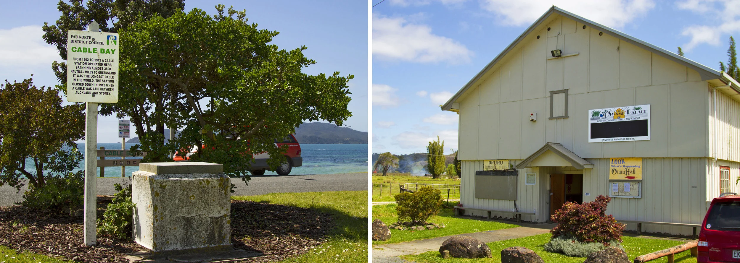
Figure 4. Part of the cable complex at Doubtless Bay, New Zealand was floated on a barge up a river to its landing spot at Oruru, where it now serves as a local community center and a cinema.
At the Far North Regional Archives, I sit at a table with residents eager to share the history of the Northland, New Zealand and their encounters at the original telegraph house, now a local cinema theater. Each recounts a movie that they had seen at the “Swamp Palace” and the extensive stories about the films that would be told by its outgoing exhibitionist. The history of the Northland station, which operated for only a decade between 1902 and 1912, isn’t limited to the archives. Images are mounted on the walls at the local “Cable Bay” general store. The landing is commemorated with a stone monument, coordinates emblazoned on its surface. These stories and the visual culture of cable history resonate across the Pacific. In another “Cable Bay” in New Zealand, on the country’s South Island, a local couple has set up Cable Bay Holiday Park, dedicating a room to images of the bay’s history – an amateur archive. The original telegraph building in Fiji has been restored to house FINTEL, Fiji’s international communications company. Even after they ceased to be hubs of communications activity, stations along the original British line have housed other social circulations – of science, of cinema, of culture. The buildings, and the histories they preserve, allude to the colonial past yet simultaneously are woven into the fabric of local networks, serving specific community needs.

Figure 5. Remnants of old telephone cables lay across the beach at Vatuwaqa, Fiji. The original telegraph building has been renovated and now houses Fiji’s international telecommnications company.
At the Far North Regional Archives, I sit at a table with residents eager to share the history of the Northland, New Zealand and their encounters at the original telegraph house, now a local cinema theater. Each recounts a movie that they had seen at the “Swamp Palace” and the extensive stories about the films that would be told by its outgoing exhibitionist. The history of the Northland station, which operated for only a decade between 1902 and 1912, isn’t limited to the archives. Images are mounted on the walls at the local “Cable Bay” general store. The landing is commemorated with a stone monument, coordinates emblazoned on its surface. These stories and the visual culture of cable history resonate across the Pacific. In another “Cable Bay” in New Zealand, on the country’s South Island, a local couple has set up Cable Bay Holiday Park, dedicating a room to images of the bay’s history – an amateur archive. The original telegraph building in Fiji has been restored to house FINTEL, Fiji’s international communications company. Even after they ceased to be hubs of communications activity, stations along the original British line have housed other social circulations – of science, of cinema, of culture. The buildings, and the histories they preserve, allude to the colonial past yet simultaneously are woven into the fabric of local networks, serving specific community needs.

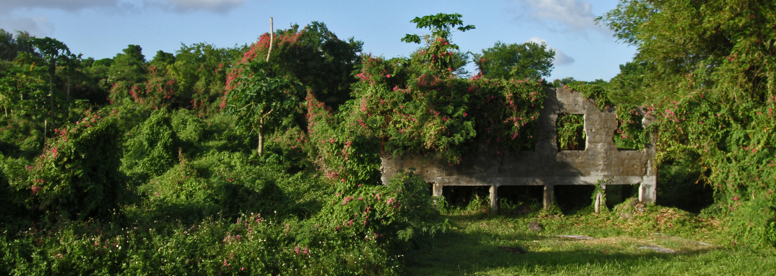
Figure 6. The ruins at Sumay, Guam remain on the Naval Base and are inaccessible to the public without a pass and an escort.
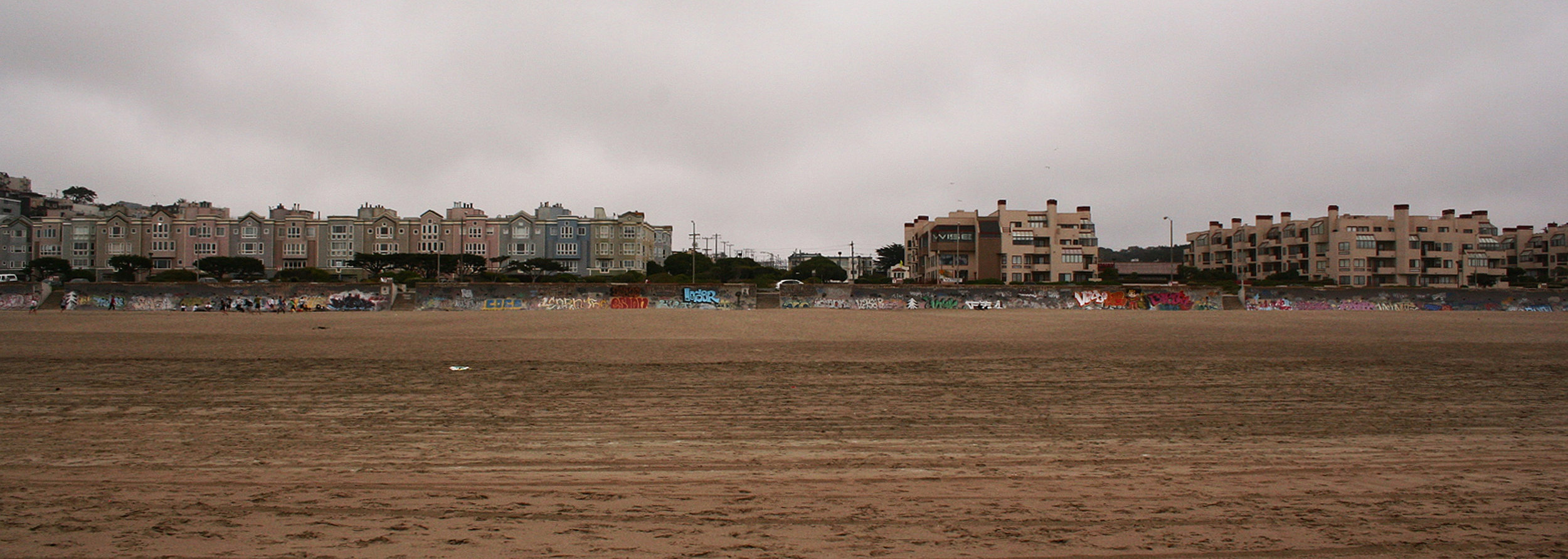
The other stations along the American transpacific telegraph line also remain unknown, unexcavated, and insignificant in their surrounding landscapes. At Ocean Beach in San Francisco numerous pictures were taken to document the original landing, but nothing remains of the cable’s infrastructure today. The original cable hut has been demolished and an apartment building has been put up in its place. Like Ocean Beach, Hawai‘i’s Sans Souci Beach is a major tourist attraction in downtown Waikiki. No street signs, monuments, or parks mark its former landing. The only mention of the cable is a brief note at the bottom of the menu of a local restaurant. The ruins at Midway Island cannot be accessed since there are no regular commercial flights to the atoll. Only military groups, research teams, and eco-expeditions that charter flights may visit. Much of Manila’s coastal shoreline has been built out into the bay. The telegraph landing point here is likely submerged beneath roads and shopping malls. Transpacific communication histories live on solely in the historical images of cable landings and commemoration ceremonies, scattered few and far between, and often buried in remote archives.
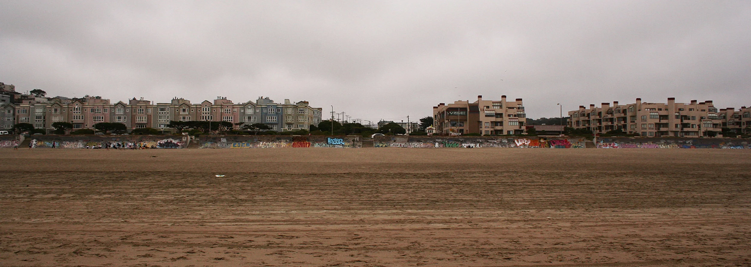
Figure 7. At the telegraph landing in San Francisco apartment buildings now stand at the location of the original cable hut.
Several of the American sites are still critical locations for signal exchange. Guam and Hawai’i remain major hubs for transpacific internet traffic. In contrast, many of the early sites along the first British Pacific routes are not close to contemporary cable landings. Just as the cables moved north from La Perouse to Sydney, and later to Sydney’s northern suburbs, cables have been dislocated from Nelson, Northland, Darwin, Bamfield, Norfolk Island and Fanning Island. Canada’s traffic is now routed south through United States cables. New Zealand’s internet leaves the country through Takapuna, north of Auckland, and Muriwai, on its west coast, rather than two original cable landings. The visibility of cable history along the British colonial route – from the museum at La Perouse to the reconstructed walls at Darwin – is accompanied by a shift away from these locations as significant telecommunications hubs. In contrast, the solidification of American telecommunications networks at nodes such as Hawai‘i and Guam is accompanied by a lack of institutional interest in the maintenance of early cable sites.
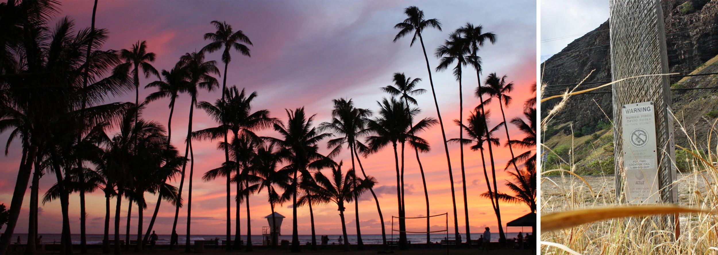
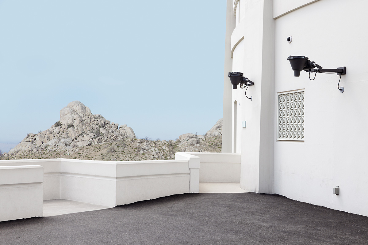
Figure 8. At Hawai‘i’s Sans Souci Beach (left), the only remnant of the original transpacific cable landing is a mention at the bottom of a restaurant menu. The poles that mark contemporary communications cables (right) blend into the dry landscape of O‘ahu’s west shore.
There are a number of practical reasons for this divergence, including the increased infrastructural awareness at typically remote British stations, the urban buildup around American stations at San Francisco and Honolulu, and the differing cultural relationships to a colonial past in the United States and in Australia, New Zealand, and Canada. Regardless, our forgetting of cable stations, especially in places that remain network hubs, serves to keep contemporary network infrastructure invisible. It is difficult to think of cable systems when they are spatially or temporally proximate. The nodes of the networks we are hooked into remain the most difficult to grasp. At stake in the forgetting of these systems is our understanding of the historical development of interconnections between places, the ongoing cost of maintenance, and the embodied difficulties of continued operation. Although cablemen are today relegated to oversight of the network, rather than the physical retransmission of messages, cable stations continue to be sites for the active monitoring and maintenance of transoceanic communications. How might we re-cast the global networks of media distribution – from the cable systems through which our internet flows; to the satellites that register the Earth’s surface; to the data centers where our information is stored – as inhabited architectures?
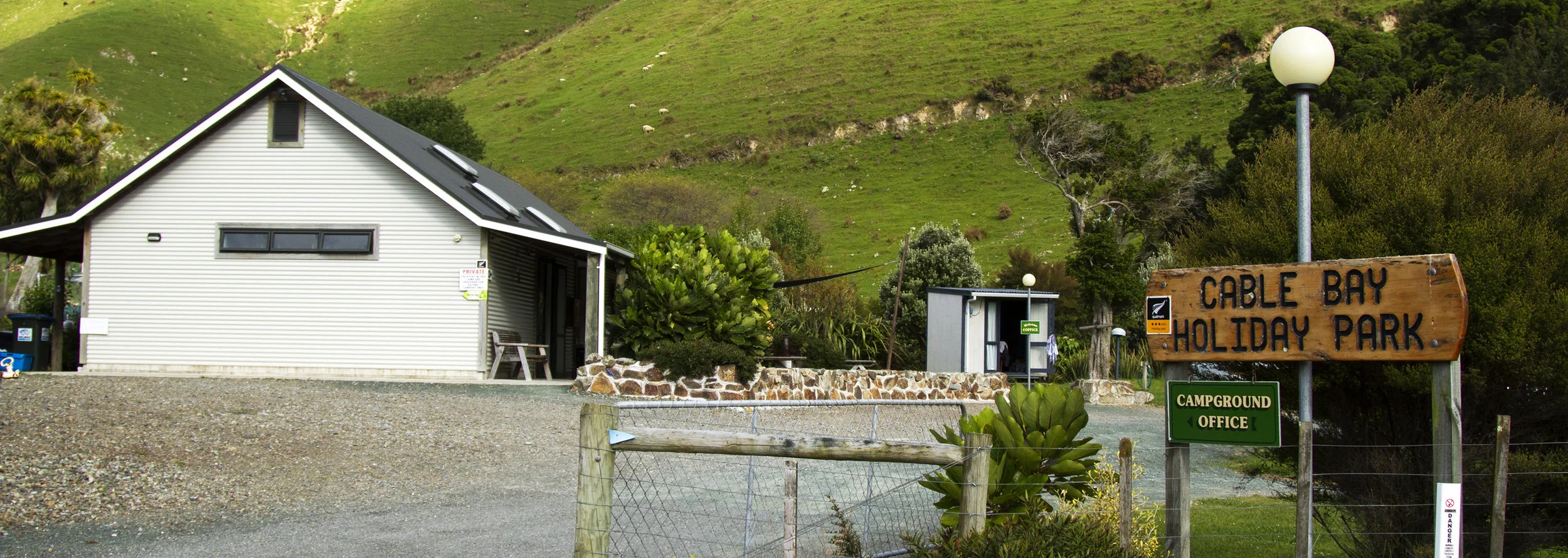
Figure 9. The cable landing at Nelson, New Zealand has been re-purposed as a campground. Inside Cable Bay Holiday Park’s reception area, an amateur archive of collected historical material documents the system’s impact.
At the climax of “White Noise,” as the engineers are listening to Moses cross the Red Sea, one of the pair suggests that they should tape and analyze the sounds emanating from the depths. The second engineer resists, arguing that if they continue to listen in and happen to overhear the voice of God, this knowledge would destroy them. “We musn’t hear it,” he exclaims, “We would know for sure. It would make a worthless thing of faith” (Kilworth 514). He pulls the plug, cuts the circuit, and fires a gun at the system. Destroying the cable station, he attempts to preserve a continued faith in the world’s mysteries and a belief in the possibility of earthly transcendence. This short story conveys at least one reality about today’s cable stations: they register traces of the past that are difficult to reconcile with the transcendence networks promise to us. As Anna McCarthy and Nick Couldry have argued, “the full recognition of the materiality of space, and spatial relations, does violence to certain visions, themselves perhaps quite comforting, of what media are” (2004: 3). It is only through the symbolic destruction of this material past that we can continue to believe in the immateriality of our communications networks. Counter to this imagination, the images here suggest that by revisiting and recording the history of cable stations, we might open up a circuit of exchange between today’s systems and the colonial infrastructures that constitute their early foundations.
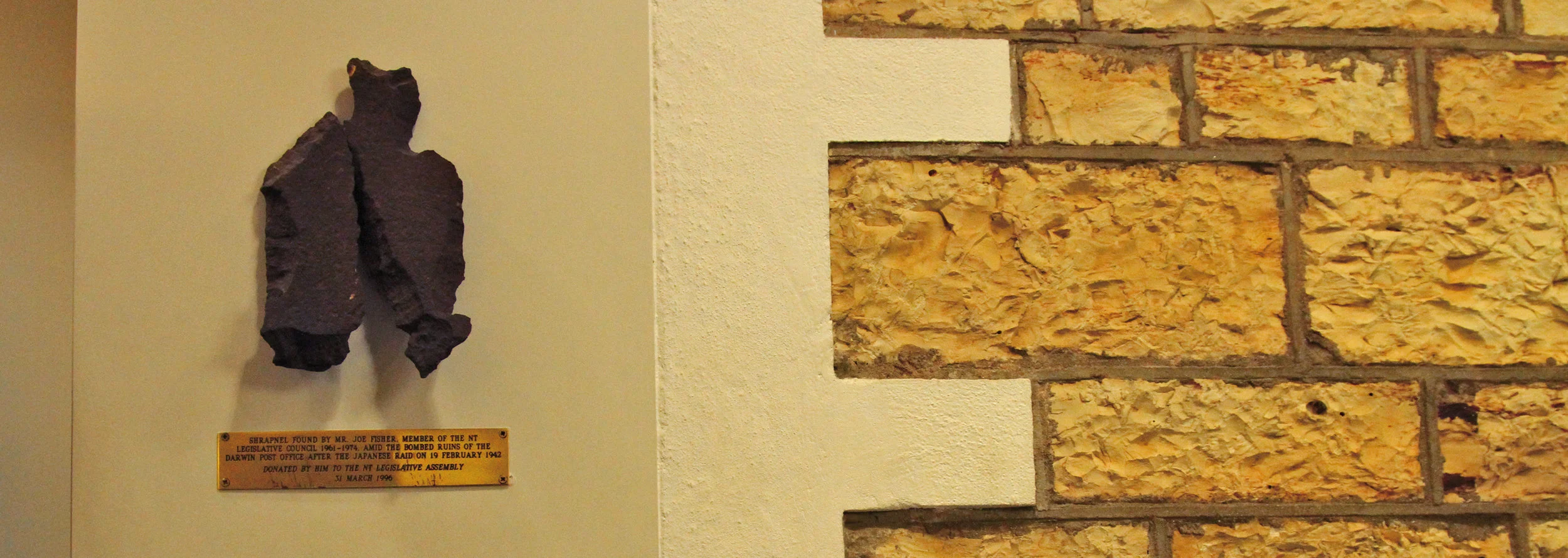
Figure 10. Bricks from the old Darwin communications complex, destroyed during World War II, are embedded into the walls of the city’s government buildings.
WORKS CITED
- Couldry, Nick and Anna McCarthy, eds. MediaSpace: Place, Scale and Culture in a Media Age. London and New York: Routledge, 2004.
- Graham, Stephen and Simon Marvin. Splintering Urbanism: Networked Infrastructures,
- Technological Mobilities and the Urban Condition. London: Routledge, 2001.
- Kilworth, Gary. “White Noise.” In Year’s Best Fantasy and Horror Volume 3, Ellen Datlow, ed.. New York: St Martin’s Press, 1990. pp. 508-16.
- Scott, R. Bruce. Gentlemen on Imperial Service: A Story of the Trans-Pacific Telecommunications Cable told in their own Words by those who Served. Victoria: British Columbia, 1994.
Nicole Starosielski is an Assistant Professor in the Department of Media, Culture, and Communication at New York University. Her forthcoming book project, The Undersea Network, examines the cultural and environmental dimensions of transoceanic cable systems, beginning with the early global telegraph network and extending to the fiber-optic infrastructure that carries almost all international internet traffic.